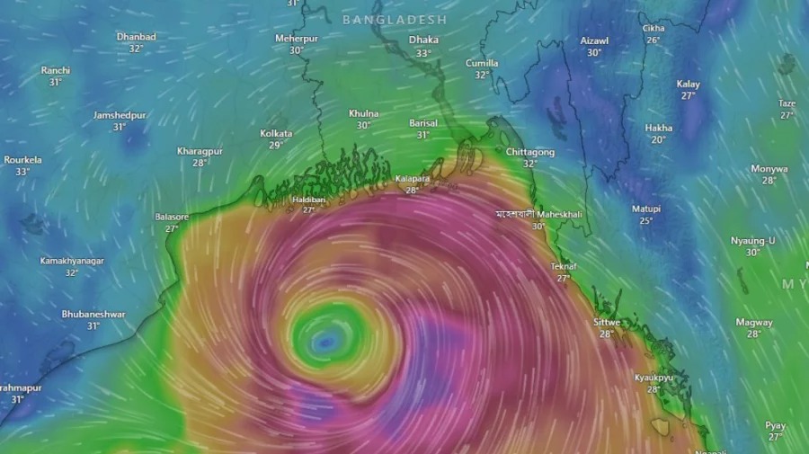
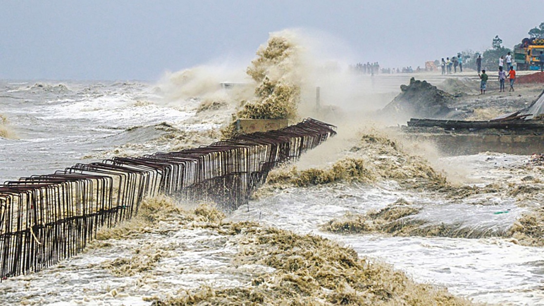
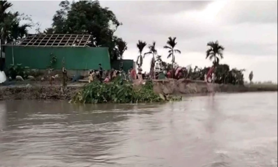
As Bangladesh is bracing for the severe cyclonic storm Remal, the country’s coastal districts are already under a great risk.
This cyclone is all set to make landfall after 6pm today.
Understanding cyclones
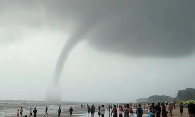
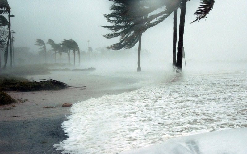
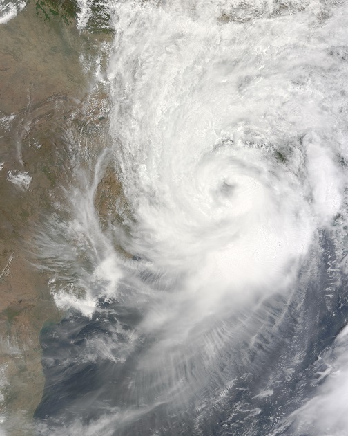
Cyclones are powerful storms with strong winds and heavy rain. They form over warm ocean waters and can cause severe damage when they hit land. Cyclone Remal is currently expected to hit Bangladesh, with high caution signals already issued at major ports. The entire country, including areas far from the coast, is preparing for heavy rainfall and strong storms.
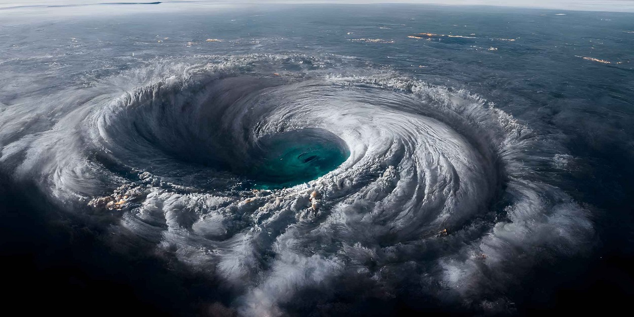
Cyclones form when warm, moist air over the ocean rises and creates a low-pressure area beneath it. This draws in more air, which then heats and rises. As this cycle continues, clouds form and the wind speeds up, creating a cyclone. The warm ocean water is crucial for the cyclone’s energy. And global warming is increasing the risk and severity of cyclones.
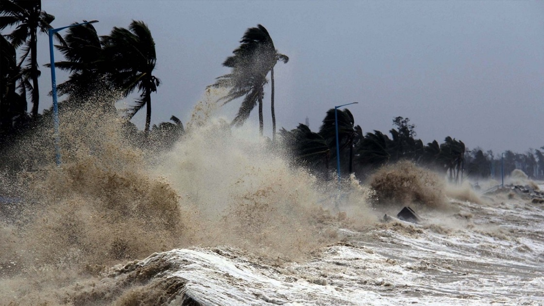
As the cyclone grows, it moves over the ocean, gaining strength from the warm water. When cyclones move over land, they lose energy but can still cause severe damage due to strong winds and heavy rain. Cyclones are classified based on their wind speeds and potential damage.
Cautionary signals and risks
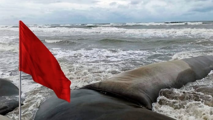
Cautionary signals are warnings issued to inform the public about the severity of an approaching cyclone. These signals range from 1 to 10, with higher numbers indicating greater danger. They help people prepare by indicating expected wind speeds, potential flooding, and other risks. Authorities use these signals to guide evacuations and safety measures.

Signal 10: Extremely dangerous
Signal 10 indicates an extremely dangerous cyclone with wind speeds exceeding 120 km/h (75 mph). Expect severe damage to buildings, uprooted trees, and widespread power outages. Floodwaters can rise above 3 meters (10 feet), inundating low-lying areas and causing significant property damage. Storm surges can lead to coastal erosion and destroy infrastructure. It is crucial to evacuate immediately if advised, secure your property, and move to higher ground to ensure safety.
Signal 9: Very dangerous
Signal 9 represents a very dangerous cyclone with wind speeds between 90-120 km/h (56-75 mph). This level poses a significant risk to life and property. Flooding can reach heights of 2-3 meters (6-10 feet), leading to severe water damage in vulnerable areas. Expect strong winds to damage roofs, break windows, and down trees. Storm surges will likely cause coastal flooding. Prepare by securing your home, staying indoors, and following evacuation orders if issued.
Signal 8: High risk
Signal 8 denotes a high-risk cyclone with wind speeds of 60-90 km/h (37-56 mph). Strong winds can cause moderate damage to structures, such as tearing off shingles and breaking branches. Floodwaters may rise up to 2 meters (6 feet), flooding basements and ground floors. Coastal areas can experience storm surges that lead to beach erosion and minor flooding. Residents should secure outdoor objects, stay indoors, and be prepared for potential power outages and local flooding.
Signal 7: Considerable risk
Signal 7 indicates considerable risk with wind speeds between 50-60 km/h (31-37 mph). While not as severe, these winds can still cause damage to weaker structures, such as loose roofing materials and small trees. Flooding can be moderate, with water levels rising up to 1.5 meters (5 feet). Coastal regions might experience minor storm surges. Secure outdoor items, remain indoors, and monitor updates from local authorities for any changes in the cyclone`s path or intensity.
Signal 6: Moderate risk
Signal 6 suggests moderate risk with wind speeds of 40-50 km/h (25-31 mph). There is a potential for light structural damage, such as broken windows and damaged roof tiles. Flooding could occur, with water levels reaching up to 1 meter (3 feet), particularly in low-lying areas. Coastal areas may see small storm surges. It`s essential to stay informed, secure loose items around your home, and prepare for minor disruptions in utilities and transportation.
Signal 5: Noticeable Risk
Signal 5 indicates noticeable risk with wind speeds of 30-40 km/h (19-25 mph). Expect minor damage to weaker structures and scattered debris from broken branches. Flooding is less likely but can still affect very low-lying areas, with water levels rising up to 0.5 meters (1.5 feet). Coastal regions might experience minimal storm surges. Residents should remain vigilant, secure outdoor belongings, and be ready for brief periods of heavy rain and strong winds.
Signal 4: Low Risk
Signal 4 denotes low risk with wind speeds of 20-30 km/h (12-19 mph). Damage is minimal, primarily limited to small branches and unsecured items. Flooding is unlikely, though there could be brief, localized water accumulation in very low-lying areas. Coastal impacts are negligible. Stay informed about weather updates, ensure outdoor items are secure, and prepare for short periods of gusty winds and rain.
Signal 3: Very Low Risk
Signal 3 indicates very low risk with wind speeds of 10-20 km/h (6-12 mph). Any damage is typically restricted to lightweight, unsecured objects and small branches. Flooding is not a concern, and coastal areas remain unaffected. Continue to monitor weather conditions and secure lightweight items outside your home. Expect mild inconveniences from brief gusts and light rain.
Signal 2: Minimal Risk
Signal 2 represents minimal risk with wind speeds of 5-10 km/h (3-6 mph). Damage is highly unlikely, with only the lightest, unsecured items potentially being disturbed. Flooding and storm surges are not a concern at this level. Stay updated with weather forecasts and ensure all loose items outside are secured. Prepare for slight breezes and occasional drizzle.
Signal 1: Negligible Risk
Signal 1 indicates negligible risk with wind speeds less than 5 km/h (3 mph). There is no significant threat of damage, flooding, or storm surges. This signal serves primarily as a reminder to remain aware of weather conditions. Stay informed and ensure that your environment is secure, but expect minimal disruptions from the weather.
What to Do in Coastal Regions
- Secure your home and property against strong winds.
- Evacuate if instructed by authorities.
- Move to higher ground to avoid flooding.
- Stock up on emergency supplies like water, food, and medicines.
- Keep important documents and valuables in waterproof containers.
- Stay informed through radio or news updates.
- Help neighbors, especially the elderly and disabled.

What to Do if You`re Not in Coastal Areas
- Stay indoors and avoid unnecessary travel.
- Keep an emergency kit with food, water, and medications.
- Charge your mobile phones and keep backup batteries.
- Secure loose items around your home to prevent them from being blown away.
- Avoid using electrical appliances during the storm.
- Stay informed through local news and weather updates.
- Help others who might need assistance.
- Keep your vehicle fueled in case of an emergency.
- Be ready for power outages; have candles and flashlights ready.
- Follow instructions from local authorities.
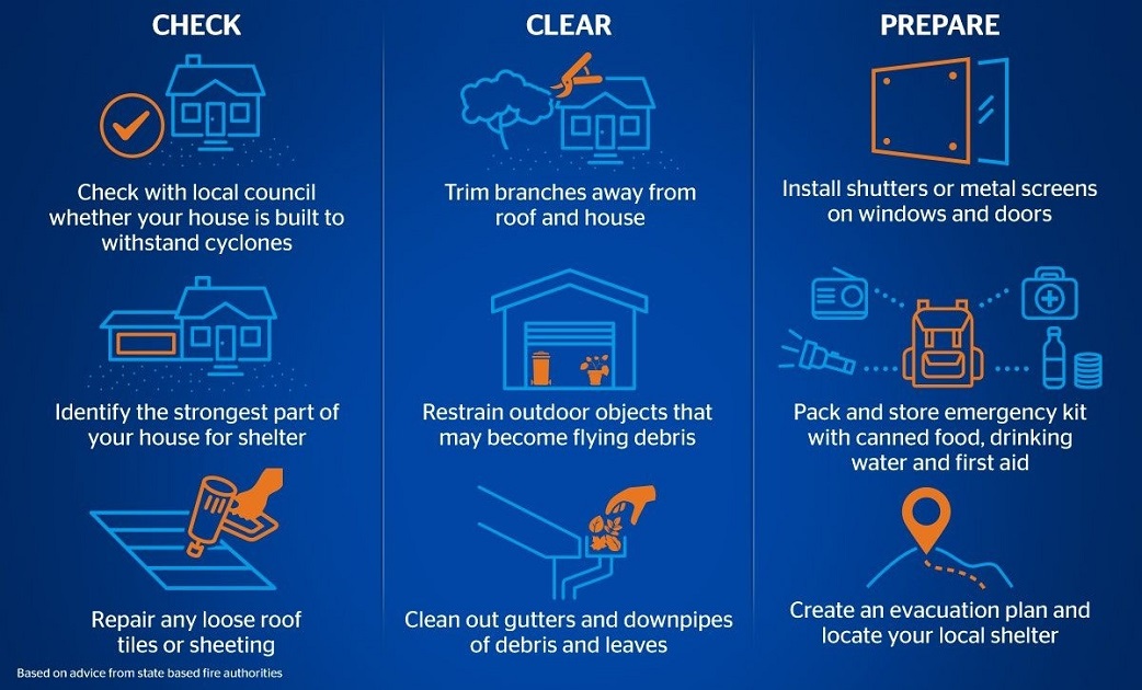
Necessary Things to Know and Do
Essential Information
- Know the nearest shelter locations.
- Have a family emergency plan.
- Understand the evacuation routes.
- Be aware of your community’s emergency response system.
- Keep updated on the cyclone’s path and warnings.
Essential Actions
- Follow official advisories and warnings promptly.
- Avoid low-lying areas and flood-prone zones.
- Prepare to leave if evacuation orders are given.
- Have cash on hand as ATMs might not work.
- Ensure your vehicle is in good condition and fueled.
Why Bangladesh is Prone to Cyclones
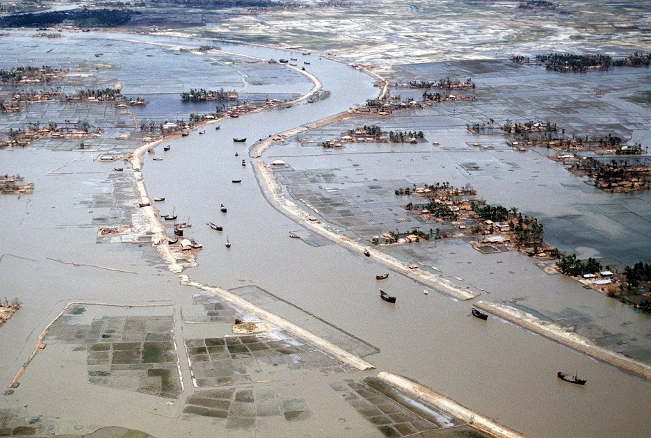
Bangladesh’s geographical location makes it highly vulnerable to cyclones. The country lies in the Bay of Bengal, which is a hotbed for tropical cyclone formation. The warm waters and atmospheric conditions here are conducive to the development of these storms.
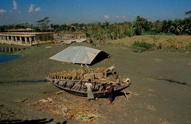
The topography of Bangladesh, with its vast delta plains, exacerbates the impact of cyclones. When cyclones make landfall, they bring heavy rains that cause rivers to swell, leading to extensive flooding. Additionally, the storm surges associated with cyclones can inundate coastal areas, causing severe damage and loss of life.
Another factor is the high population density, especially in coastal areas. Many people live in low-lying regions and are highly exposed to the dangers of cyclones. The combination of physical geography and human factors makes Bangladesh particularly susceptible to the devastating effects of tropical cyclones.
Prominent cyclones in Bangladesh
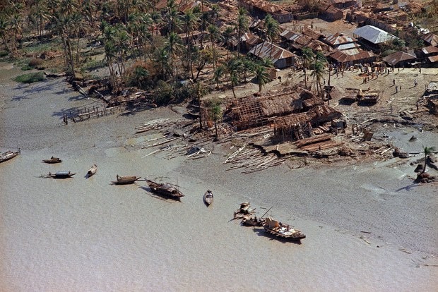
1. Cyclone of 1991
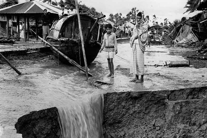
The cyclone on the night of 29 April 1991 was one of the deadliest, with wind speeds up to 155 mph. According to NOAA Backgrounder It killed 138,866 people, leaving as many as 10 million homeless deaths, and widespread destruction with a 6-meter (20 ft) storm surge inland over a wide area. The financial losses were immense, with damages estimated $1.8 billion–$3.0 billion in economic impact according to the Asian Development Bank.
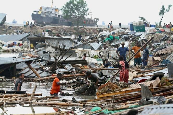
2. Cyclone Sidr (2007)
Cyclone Sidr hit Bangladesh on November 15, 2007, which resulted in death tolls between 3,100 and 10,000 according to Save the Children’s estimation. Meanwhile, the Red Crescent Society reported on November 18 that the death toll could reach up to 15,000. The storm surge and high winds led to significant destruction, with damages estimated at $1.7 billion according to The World Bank’s data. The cyclone left millions homeless and severely impacted the country’s economy.
3. Cyclone Aila (2009)
Cyclone Aila struck in on May 23, 2009, resulting in around 190 deaths and causing widespread flooding. The financial losses were about 269.28 million U.S. dollars according to a research report of reliefweb. The cyclone displaced millions and led to severe water and food shortages.
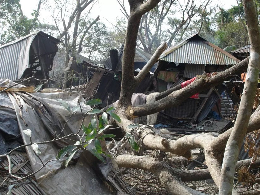
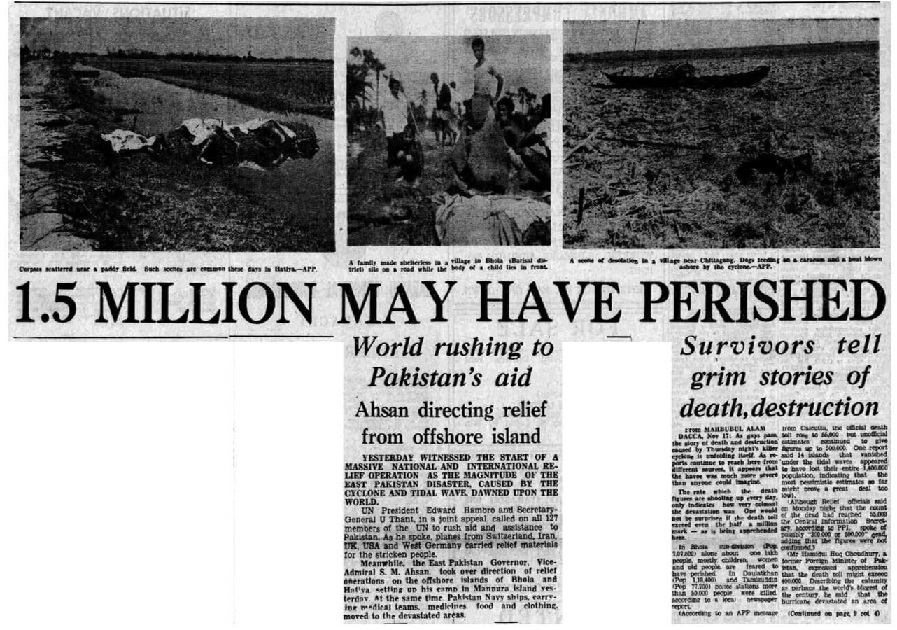
4. Cyclone Bhola (1970)
The 1970 Bhola cyclone with winds of 185 km/h (115 mph) on November 12, remains the deadliest cyclone in history, with an estimated 300,000 to 500,000 deaths, according to the World Meteorological Organization and Business Insider India. It caused unimaginable devastation, with entire villages wiped out and damages running into billions of dollars.
5. The Great Backerganj Cyclone of 1876
The Great Backerganj Cyclone of 1876 occurring from October 29 to November 1, was one of the deadliest tropical cyclones in history. It struck the coast of Backerganj in the Bengal Presidency of British India (near the Meghna estuary in present-day Barisal, Bangladesh), resulting in approximately 200,000 deaths. Half of the victims drowned in the storm surge, while the rest succumbed to the ensuing famine according to research by SAARC and data from Banglapedia.
Cyclones pose a significant threat to Bangladesh due to its geographical and topographical vulnerabilities. Understanding how cyclones form, the associated risks, and how to prepare and respond can save lives. Cyclone Remal is a reminder of the ongoing challenges posed by climate hazards. As we face these natural disasters, preparedness and community support are essential in mitigating their impact.


-20260720043233.jpg)