
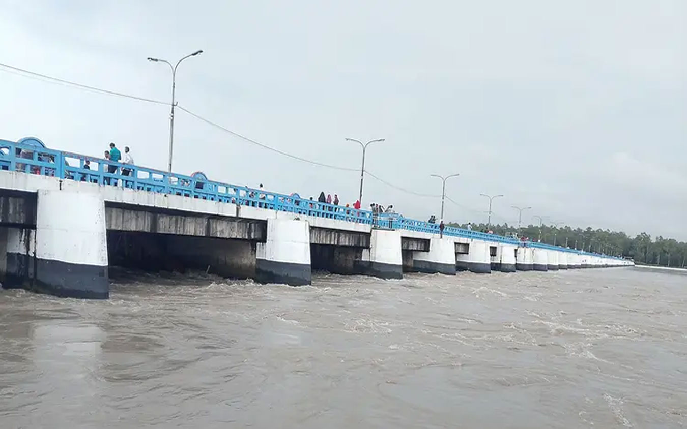
The water level of the Teesta River is steadily rising due to upstream surge. To manage the situation, authorities have opened all 44 gates of the Teesta Barrage at Dalia Point in Nilphamari.
As a result of the rising water, residents of char areas and low-lying regions along the Teesta basin are experiencing growing fears of flooding. Local administration and the Bangladesh Water Development Board (BWDB) are maintaining round-the-clock monitoring to protect lives and property in riverbank areas.
Executive Engineer of the BWDB’s Dalia Division, Amitabh Chowdhury, said that at 6:00 a.m. on Tuesday, the river was flowing 5 centimeters below the danger level at Dalia Point. By 9:00 a.m., it had dropped further to 10 centimeters below the danger level.
He further noted that the water is currently flowing 15 centimeters below the danger level, and that all 44 gates of the Teesta Barrage have been opened to regulate the flow.
Earlier, at 9:00 p.m. on Monday, the Teesta River at Dalia Point was flowing 10 centimeters below its danger level of 52.15 meters. On Saturday as well, the river had been flowing 5 centimeters below the danger level.
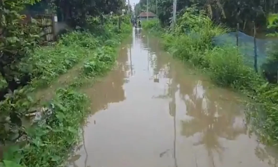
Meanwhile, rising water levels have once again begun inundating agricultural land in the Teesta char areas. Locals said that sudden water increase since Monday night has started to enter low-lying areas of Dimla Upazila along the river.
Residents in low-lying areas of several unions—including Purba Chatnai, Khogakharibari, Tepakharibari, Khalisha Chapani, Jhuna Gachh Chapani, and Goabari in Dimla Upazila, as well as Golmunda, Dawayabari, and Shaulmari in Jaldhaka Upazila—are already making necessary preparations.
Nural Islam, a water level reader at the Dalia Flood Forecasting and Warning Center of BWDB, said that at 9:00 a.m. on Monday, the water level was 51.78 meters, which was 37 centimeters below the danger level. By noon, it dropped slightly to 51.76 meters, remaining unchanged until 3:00 p.m.
He added that over the next three hours, the water level rose rapidly to 51.98 meters (17 centimeters below the danger level) at 6:00 p.m. It then increased by another 7 centimeters over the next three hours, reaching 52.05 meters by 9:00 p.m., which is 10 centimeters below the danger level.


-20260707132332.jpg)


-20260712062551.webp)